hdl:10013/epic.39097
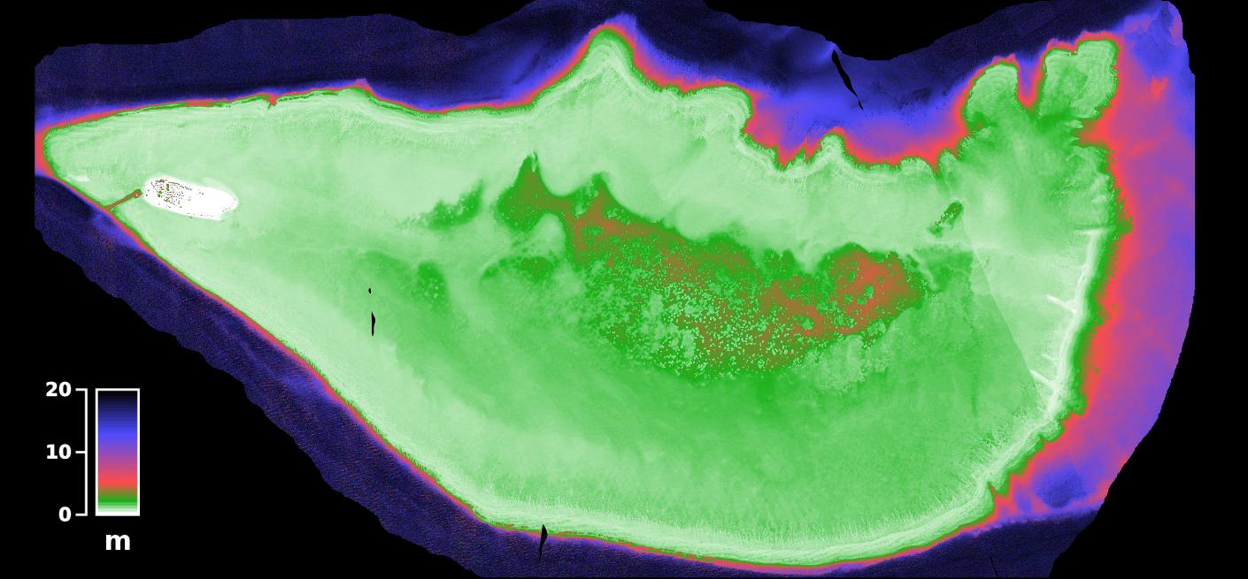
Bathymetric map of Heron Reef, Australia, derived from airborne hyperspectral data at 1 m resolution
Contact
epicdocumentation [ at ] awi.de
Abstract
Item Type
PANGAEA Documentation
Authors
Divisions
Programs
Publication Status
Published
Eprint ID
30174
Cite as
Hedley, J.
(2012):
Bathymetric map of Heron Reef, Australia, derived from airborne hyperspectral data at 1 m resolution
,
Bremerhaven,
PANGAEA
.
Download
![[thumbnail of HRCASI_full_zpl_pair13_dist_BATHY_5M_depth_detail.tif.gz]](https://epic.awi.de/style/images/fileicons/application_x-gzip.png)
Cite this document as:
![[thumbnail of heron_bathy_coloured_12pct_withkey.png]](https://epic.awi.de/30174/7/heron_bathy_coloured_12pct_withkey.png)

Preview
Cite this document as:
Share


Geographical region
Research Platforms
Campaigns
N/A
Actions
 Edit Item